Company
NSW Department of Planning, Industry and Environment (DPIE)Location
Upper Hastings Valley, Clarence Valley and DungogDate
November 2018 - July 2019Ecology
Government & Defence
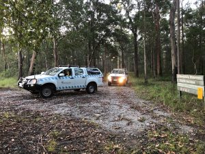
We were engaged by the Office of Environment and Heritage (now DPIE) to carry out standardized Koala surveys at 171 sites across the Port Macquarie-Hastings, Clarence, Dungog and Mid Coast Local Government Areas. This required extensive project planning, arranging access with many private landowners and authorities and the scheduling and mobilization of field teams to carry out the work.
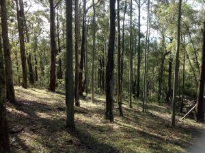
The surveys comprised the Spot Assessment Technique which involves searching for Koala scats under 30 trees per site. Rapid vegetation surveys and habitat assessments were also undertaken at each site. The data we collected was fed into the statewide Koala Likelihood map which shows where Koalas are likely to be found across NSW. This is used for conservation planning and research.
Our surveys found higher than expected levels of Koala usage across the survey areas, especially in large areas of continuous forest in the eastern parts of the Great Dividing Range.
Key deliverables of project:
- Arranging landholder access to private land and liaising with authorities for access to National Parks, State Forests and Crown Land
- Koala Spot Assessment Technique Surveys and rapid vegetation pots at 171 sites across the Hastings, Clarence and Hunter Valleys
- Collection of Koala scat samples and postage to universities for research
- Collation of all survey data and upload to Bionet